Field Note № 005 — Geolocation OSINT
Point of Origin
A crater, a church, and a street in Ukraine.
This month's Bellingcat challenges have all been about blast analysis and they have been fun to work through. This challenge gave one photo of a crater in a Ukrainian street. Two questions. What street is this and from which direction was the munition fired?

This writeup contains the solution. If you want to try the challenge yourself first, it is available at challenge.bellingcat.com.
Geolocating the street
The first step was identifying the street. I used Google Reverse Image Search. Instead of running the whole photo I cropped it tight on the church in the background. The church has a distinctive shape and that is usually enough on its own.
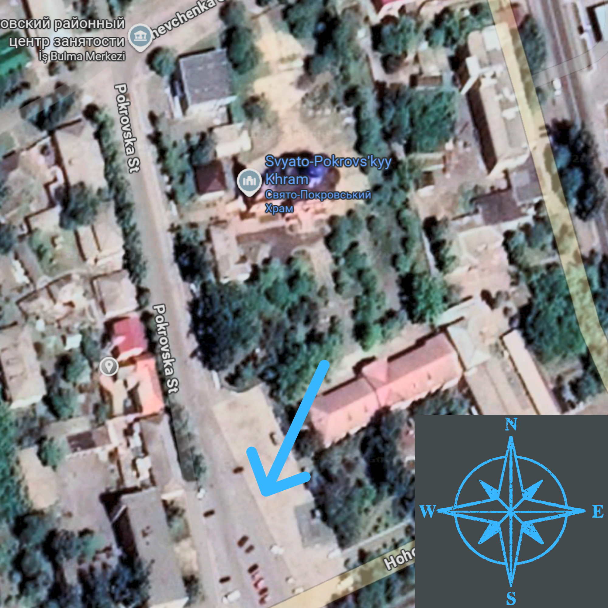
The search returned a few photos of the same church but none of them named it directly. However, I discovered an article that identified the church's general location. This led me to search the town of Orikhiv in Ukraine's Zaporizhzhia region on Google Maps. There are only two churches in the area and the one matching our image is the Svyato-Pokrovskyy Khram (Свято-Покровський храм).
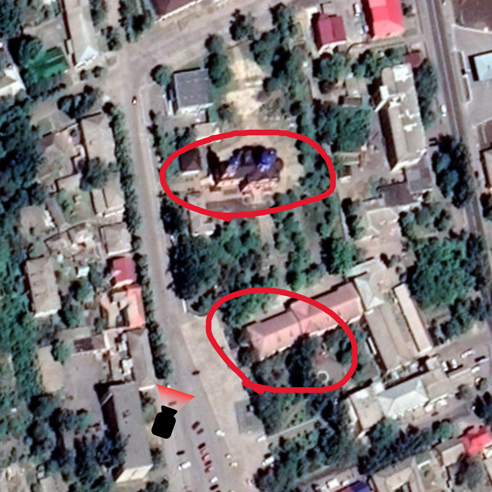
There is only one angle in the area where the white building and the church behind the trees line up the way they do in the photo. That gave me the exact spot. The coordinates are 47.575376, 35.785224. The street is Pokrovska (Покровська).
Reading the crater
The second question was about direction. To work out where the munition came from I needed to look closely at the edges of the crater, then match that to a compass bearing on Google Earth.

The uplifted, fractured edge of the asphalt is facing the camera. This tells you which way the munition was moving. The blast pushes material in the same direction the munition was travelling. So the munition came from the background of the photo and moved toward the foreground.
Lining up the North-aligned map with the photo, the uplifted edge of the asphalt is pointing south. The asphalt was pushed south, which means the munition came from the north. That is the point of origin.
The church gave us the street. The crater edge gave us the direction.
Thanks to the Bellingcat team for this one. The crater analysis was the best part. It made me slow down and look closely at what the blast actually left on the road.